Supported by


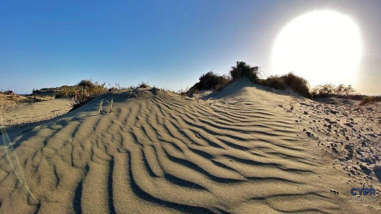
Desert in Cyprus? Photos taken on the Akrotiri peninsula near Limassol might give that impression. Sandy hills, wind-blown waves, and low vegetation make some parts of the coast resemble a landscape more often associated with Africa than the eastern Mediterranean.
They are not a desert, however. Akrotiri coastal dunes – part of a unique natural system that also includes a salt lake, wetlands, salt pans, reed beds, and beaches. Geological studies have shown that the development of the western dune field began around 56.2 thousand years ago.
The term “Limassol desert” can be found in local materials, social media and descriptions of the peninsula.
This mainly concerns the sandy areas of Akrotiri, especially those located south of Lady’s Mile and in the area of Button Beach and the western part of the peninsula.
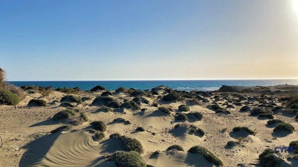
Once there, the landscape can truly be surprising.
Some sections are almost devoid of tall vegetation. The wind shifts the loose sand, creating ridges, depressions, and characteristic waves.
If you frame the photo properly and don't show the sea, you can easily convince someone that it was taken in the desert.
A desert is an area defined primarily by very little rainfall and the resulting climatic conditions.
Akrotiri is not such an area.
This coastal dune system, which is created by sand brought to the coast and then carried inland by the wind.
The development of dunes is influenced by, among others:
The term "Akrotiri Desert" is therefore an effective local shorthand. Scientifically, we're talking about dune fields.
Their true story turns out to be much more interesting than the desert name itself.
In 2021, scientists Miltiadis Polidorou and Niki Evelpidou published a detailed study on the geomorphology of the Akrotiri dunes.
They identified two large dune fields on the peninsula: western and eastern.
The oldest sample tested from the western field gave the result 56.2 thousand years, with a margin of error of 5,500 years. This does not mean that every grain of sand visible on the surface today has been there for that long.
Over thousands of years, the dunes have undergone successive phases of formation, displacement, erosion and re-accumulation of sediments.
However, the result shows that the history of the western dune system began already in the Late Pleistocene.
There were no pyramids then.
There were no first cities.
People did not know agriculture.
And the sand on Akrotiri already formed part of the landscape, the remains of which we can still see today.
The method used to determine age was OSL, i.e. optically stimulated luminescence.
It allows us to estimate when mineral grains – in this case quartz – were last exposed to light before being covered by subsequent layers of sediment.
Simply put, sand grains store a small record of natural radiation exposure. Once a sample is collected under the right conditions, scientists can measure the signal and estimate the time elapsed since the grains were buried.
This allows the study of dunes, ancient beaches and other deposits that do not contain materials suitable for the more familiar radiocarbon dating technique.
When the western dune field began to develop, the relative sea level was, according to researchers, approximately 60 meters lower than today.
So the coastline looked completely different.
Much of the seabed of today's coastal waters was exposed, and the wind could have carried sand from former beaches and other sandy surfaces.
Researchers indicate that the western spit connecting the former island of Akrotiri with the mainland existed around 56,000 years ago. At that time, the eastern side still provided a connection between the bay and the open sea.
Subsequent changes in climate, sea level, wave action and tectonic processes have repeatedly rebuilt the entire area.
The southern part of modern Akrotiri was once an offshore island.
Over time, sediments deposited by water and wind began to form connections with the mainland. This sandy or gravel connection between the island and the mainland is known as tombola.
The connection on the western side was developed first.
Later, the eastern spit was formed. It closed off the former bay, helping to shape the area of today's Akrotiri Salt Lake.
The modern peninsula is therefore a geological puzzle created by the sea, rivers, waves, sand, wind and changing water levels.
The landscape of Akrotiri is not finished.
There are some on the peninsula embryonic dunes, i.e. the first stages of dune development, forming just behind the beach.
Wind-blown sand begins to collect around small obstacles and vegetation, creating small mounds, ridges, and undulating surfaces.
Further from the shore there are so-called white dunesThese are still active formations where the sand is shifting, but characteristic vegetation is already appearing.
On the western side of the peninsula, researchers also described partially fixed dunes and ancient dunes whose sand cemented over time and turned into a rock called aeolianite.
On Akrotiri you can see different stages of dune development – from fresh accumulations of loose sand to partially or completely rocky formations.
The inconspicuous plants growing from the dunes are of great importance.
Their roots stabilize the ground, and their stems slow the wind. The sand carried by the wind begins to accumulate around the plants, gradually enlarging the dune.
One of the characteristic species is Pancratium maritimum, or sea lily. Other plants resistant to salinity, drought, strong winds, and regular sand burying also grow on the dunes.
Conditions are difficult.
The plant must survive high temperatures, lack of fresh water, salinity and constant shifting of the substrate.
If vegetation is destroyed, the sand begins to move more easily and the entire dune becomes more susceptible to erosion.
The dune system also has a very practical function.
It is a natural reservoir of sand and a barrier protecting the areas further away from the action of the sea.
During strong storms, waves can remove some of the sand from the beach. During calmer periods, the material can gradually return, and the winds can carry it back towards the dunes.
Thanks to this, the natural beach and dunes form a system capable of partial reconstruction.
However, the process only works properly if the sand supply, natural sediment movement and vegetation stabilizing the terrain are maintained.
Removing dunes or cutting them through with roads could deprive the coast of one of its most important natural shields.
From a distance, dunes may look like empty sand.
In fact, they are a habitat for plants, invertebrates, reptiles and birds adapted to very difficult conditions.
One of the characteristic reptiles associated with sandy areas is Acanthodactylus schreiberi, known in English as Schreiber's fringe-fingered lizard. The species occurs in Cyprus and a limited part of the eastern Mediterranean region.
The lizard moves well on loose, hot sand. Its bright color helps it blend into its surroundings.
The entire peninsula is also of great importance for birds. In spring and autumn, species migrating between Europe and Africa stop here.
Sea turtles nest on the beaches of Akrotiri, and the southern coast of the peninsula also includes partially submerged sea caves.
Desert?
Rather, one of the most naturally diverse places in this part of the island.
The contrast is extraordinary.
Next to the dry sand there is Akrotiri Salt Lake, the largest internal water reservoir in Cyprus.
Its area is approximately 10.65 km²This is a seasonal reservoir – in winter it fills with water and becomes a resting place for thousands of birds, while in summer it largely dries out.
In the colder months you can observe flamingos there, among other things.
Within a few kilometers there are:
The Akrotiri Peninsula is the largest complex of natural wetlands on the island and one of the most important birdlife destinations in Cyprus.
The history of the name of one of the most famous beaches in the Limassol region is also connected with the peninsula.
According to popular local news Lady's Mile was named after a mare belonging to a British governor who was said to have ridden a horse along the coast.
The beach stretches for about five kilometers.
At its southern end, the landscape begins to change. The developed sections of the coast gradually give way to the wilder, sandier areas of Button Beach and the rest of Akrotiri.
The mare story itself is a local story about the origin of the name, not a well-documented historical event. However, it remains the most frequently repeated explanation for the beach's name.
Akrotiri is not an amusement park or a prepared attraction with marked walkways throughout the area.
Some of the roads are unpaved, and the peninsula includes wetlands, military areas, nature conservation areas, or areas with restricted access.
Safest:
A good place to start exploring the peninsula is the Akrotiri Environmental Education Centre. There you can learn more about the lake, wetlands, birds, and other habitats throughout the area.
In the photo we see sand, sun, low plants and traces left by the wind.
Almost a desert.
However, biologically and geologically, there is a lot going on here.
The western dune field began developing over 50,000 years ago. Younger dunes continue to form. Plants retain sand, and the entire system helps protect the coast from erosion.
Specialized animals live among the dunes, turtles nest on the beaches, and a few hundred meters further on begins a huge complex of wetlands.
Therefore, the answer to the question: “Is there a desert in Cyprus?” it reads:
No. But there is a place that in photos might look exactly like one of them.
Sources: Geosciences, University of Athens, Deputy Ministry of Tourism – Visit Cyprus, Visit Akrotiri, BirdLife Cyprus.