Supported by


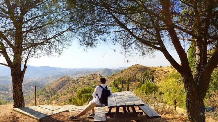
Troodos was once the bottom of the oceanIt sounds incredible, especially standing today at an altitude of almost two kilometers, amid pine trees, mountain villages, and winter snow. However, the geology leaves little doubt – the rocks that make up the central part of the island were formed about 92 million years ago as fragments of oceanic crust.
The highest peak in the Troodos Mountains, Mount Olympus, reaches 1,951 meters above sea level. However, some of the rocks exposed in its vicinity were once formed several kilometers below the ocean's surface. This makes Cyprus one of the most important locations in the world for geologists studying the structure of the oceanic crust.
About 92 million years ago, the Troodos Mountains as we know them did not yet exist.
In the present-day ridge, processes related to the spreading of the floor of the former Neotethys ocean occurred. Magma rose to the surface, creating new oceanic crust. The Geological Survey Department indicates that this process occurred in a zone located above the subduction zone.
The sequence of rocks created in this way is called Troodos ophiolite.
An ophiolite is a fragment of ancient oceanic lithosphere that has emerged on the land surface as a result of tectonic processes.
Troodos is unique in this respect. The Cyprus Geological Survey Department describes it as one of the most complete, best exposed, and best preserved ophiolite sequences in the world. UNESCO also describes it similarly.
The most interesting thing is that subsequent layers of ancient oceanic crust can still be found in the field.
The Troodos contains rocks from the Earth's upper mantle, rocks formed in ancient magma chambers, a complex of magma veins and lava that poured directly onto the ocean floor.
It's a bit like a huge piece of the ocean floor being cut open, lifted up, and exposed to the surface.
Even more interestingly, the rock arrangement today is partially topographically "inverted." The deepest elements of the ancient oceanic sequence can be found in the uppermost part of the range, while younger and shallower layers appear increasingly farther out on its margins.
It's worth knowing
Near the summit of Olympus, rocks from the deepest part of the ancient oceanic crust and the Earth's upper mantle are exposed. In other words, driving high up in the Troodos Mountains, you can find rocks that formed several kilometers beneath the ancient ocean.
One of the most characteristic evidences of the ancient presence of the ocean are pillow lavas, That is pillow lavas.
They form when extremely hot lava erupts underwater. Its outer surface cools rapidly, creating rounded, pillow-like structures.
The Geological Survey Department now identifies pillow lavas as one of the main volcanic layers of the Troodos ophiolite.
Today, rocks that once formed on the ocean floor can be seen on dry land.
This is one of the most tangible pieces of evidence of the island's extraordinary geological past.
This did not happen in one violent disaster.
For millions of years, the tectonic plates in the region have shifted. The movement of the African plate towards Eurasia led to subsequent collisions and changes in the area's geology.
The Geological Survey Department reports that the Troodos Mountains began emerging from the sea in the Miocene. Subsequent tectonic processes gradually uplifted the massif. Transformation of the upper mantle rocks and the associated changes in their density and buoyancy also played a significant role.
About two million years ago, another phase of strong uplift of the range occurred.
As a result, rocks that began their history under the ocean found themselves almost two kilometers above present-day sea level.
The geology of Troodos also explains something we already know from the island's history – the enormous importance of copper.
During the formation of the ancient oceanic crust, hot water circulating through the rocks transported dissolved minerals. Sulphide deposits containing, among other things, copper were formed near the ancient ocean floor. The Geological Survey Department indicates that these deposits are directly related to the volcanic rocks of the Troodos ophiolite.
Millions of years later, these raw materials played a huge role in the economy and history of Cyprus.
Geology thus laid the foundation for something that humans exploited much later.
Troodos is more than just a local geological oddity.
Since the 1960s, the ophiolite has attracted researchers from around the world. Its exceptionally well-preserved structure has helped scientists understand how oceanic crust is formed and its internal structure.
The importance of this area is confirmed by UNESCO. Troodos UNESCO Global Geopark is on the official list of UNESCO world geoparks, and within its area 38 geosites have been designated presenting individual elements of the geological history of the massif.
The former Amiantos mine site also houses the Troodos Geopark Visitor Center. It houses collections of rocks and minerals, geological models, and mining-related exhibits.
Today, Troodos is associated with completely different images.
Forests.
Vineyards.
Stone villages.
In winter also with snow.
Beneath all this, however, lies a history much older than man.
The rocks we walk on high above the sea began their journey on the ocean floor about 92 million years ago. Some formed even deeper – in the lower parts of our planet's oceanic crust and upper mantle.
So, on your next trip to Troodos, it's worth looking at the rocks along the road a little differently.
They weren't always mountains.
They used to be under the ocean.
The material was prepared on the basis of information from the Geological Survey Department of the Republic of Cyprus and UNESCO.